
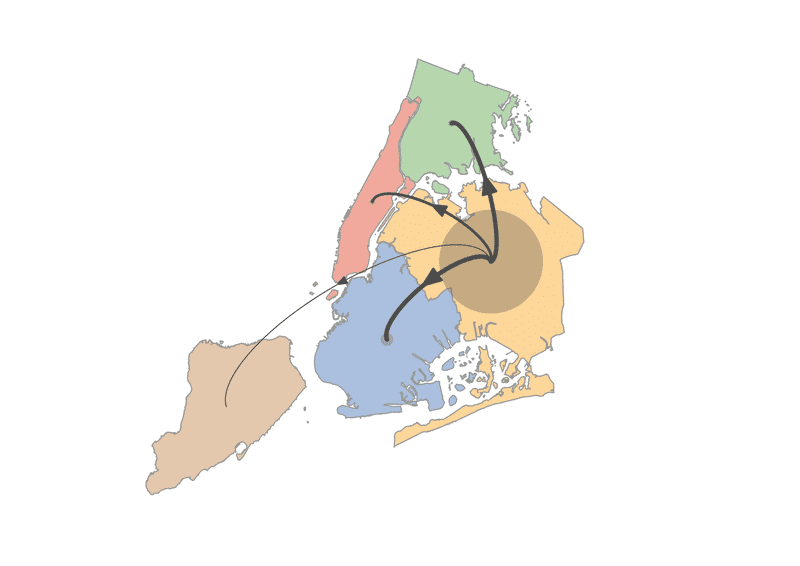
New York City’s first COVID-19 surge was fueled by cases circulating in Queens, and to some extent north Brooklyn, before then spreading into Manhattan, according to a new study from an international team of scientists.
The report, published Thursday in the journal PLOS Pathogens, analyzed tiny genetic differences in coronavirus samples to trace lineages of the germ that had infected patients around the city. This process is called phylogeographic analysis.
The findings confirm the understanding that the virus was circulating early in Queens at high rates—made evident by the elevated hospitalization burden in the borough. The report reiterates that health care and pathogen surveillance need to be more equitable in areas that are home to essential workers. Dr. Adriana Heguy, director of the Genome Technology Center at NYU Langone, spoke with WNYC's Sean Carlson about how policymakers can use these genetic findings to improve public health.
Click "Listen" in the player, and for more on the story, head to Gothamist.